Larapinta Trail Diary

I stood quietly absorbing the spectacular views; in one direction dramatically crimson coloured mountain ranges pushed up out of a vast and seemingly empty plain, above an eagle lazily soaring on the gentle thermal winds and below, a precarious trail clinging to the side of the cliff.
The persistent cawing of crows brought me back from my reflections and I visibly relaxed, knowing we’d successfully climbed to the top of Brinkley Bluff, one of the most challenging sections on the Larapinta Trail.
The strain of the last few weeks immediately slipped away into insignificance.
-
Skip ahead to specific days
Day 1 Alice Springs to Wallaby Gap via Telegraph Station
As we walked slowly away from Alice Springs, not only did we leave behind the busyness of that lively town, we immediately felt ourselves shedding the stress and uncertainty of the last few days. International travel has a way of chewing you up and spitting you out and having missed our connecting flight in Melbourne, we felt more than a little chewed up.
Following a broad concrete path alongside the river, we spontaneously fell into step. Andrew strolling casually while I, distracted by endless photo opportunities scampered alongside him. Having hiked thousands of kilometres together, it’s a pattern we’re familiar with and we comfortably settled into our new environment.
We’d flown direct from New Zealand’s winter and the contrast couldn’t have been greater or more welcome. Gum trees flanked the path offering a little shelter from the early morning sun while parrots squawked loudly from high in the branches.
The river, the first of many that we hoped to encounter was wide though instead of clear cooling water, the sandy riverbed had tyre marks and foot tracks crisscrossing it. Randomly, a guy came towards us pushing a supermarket trolley with what appeared to be his worldly possessions.

Telegraph Station, Alice Springs, Australia
Approaching the historic Telegraph Station the sounds of vehicles and excited children reminded us that we’d barely started on what was to be a 230 kilometre hike.
Beautifully preserved, the Station and grounds represent a significant time in Australia’s history. Established in 1871, it served as a pivotal link along Australia’s Overland Telegraph Line, not only connecting Darwin and Adelaide but importantly, linking the continent into the broader telegraph network of the British Empire.
With the advent of technology, it’s hard for us to even comprehend it taking months for a message to get from Australia to London. Once the telegraph link was completed, messages could be in London in as little as five hours, an astounding feat for the time.
Leaving the Station, it wasn’t long before we pulled on our fly nets for the very first time. Although winter it was hot, very hot at 26° Celsius and the flys were determined to find any moisture they could.
Scrambling up a small embankment to reach the shade of a tiny tree, Andrew announced it was time for lunch. I was more concerned with how casually he plonked himself down amongst the spinifex with visions of snakes and creepy crawlies in the forefront of my mind. Somewhat more cautiously, I found somewhere to perch and there on the side of the track, we learnt how to eat with a fly net on.
Day 2 Wallaby Gap to Simpsons Gap
Leaving Wallaby Gap I reproached myself for not listening to my own advise. Yesterday we’d met someone headed in the opposite direction who’d confirmed that yes as it happened, there were wallaby’s at Wallaby Gap.
It was dusk when we arrived at the campsite and what with the hustle and bustle of setting up camp and preparing food, I’d postponed exploring the side trail into the gap until morning. By then, there wasn’t a wallaby to be seen though admittedly, the other hikers who we’d shared the site with had been fortunate to see a couple of wallabies the night before.
The Black Footed Rock Wallaby stands at only fifty centimetres tall and are most active at dusk when they come out to graze. Being so small and also very shy, these little marsupials can be very hard to spot spending most of their time hiding under rocky outcrops. With their thick coats remaining in the shade would seem the most sensible way to spend the day.
Sadly, the Black Footed Rock Wallaby is predated on by foxes, feral cats and habitat destruction and are listed as Vulnerable and Near Threatened.

Creepers Toe Socks
I’ve had the pleasure of wearing Creepers Toe Socks for many thousands of kilometres including the 3,000 km Te Araroa in New Zealand, twice to Everest Base Camp in Nepal and now, the Larapinta Trail in Australia.
Such diverse trails and conditions including walking through rivers, snow, mud, road and rocky terrain and I couldn’t do it half as comfortably without these socks!
Receive 10% off your Creepers Toe Socks NOW
Gazing down from our highpoint on the aptly named Hat Hill we could make out a sealed road, tour buses, cars, caravans and more excitingly, public toilets alongside a shelter. Though the Larapinta Trail is oft described as isolated, once again popping out into into the midst of squeaky clean tourists was going to take a little getting used to. More so for them having coming across a bunch of hikers with attendant swarm of flies.
In an admirable attempt at team building, the flies generously shifted their allegiance to this new group of hapless victims who only now were appreciating why we were wearing fly nets.
Simpsons Gap, Larapinta Trail, Australia
Although still mid afternoon, Andrew and I quickly established ourselves in the hiker shelter located some distance from the swarming tourists with their attendant flies. After so much rushing in the last few days, we planned to have a relaxing afternoon and only then, head over to see what all the fuss was about.
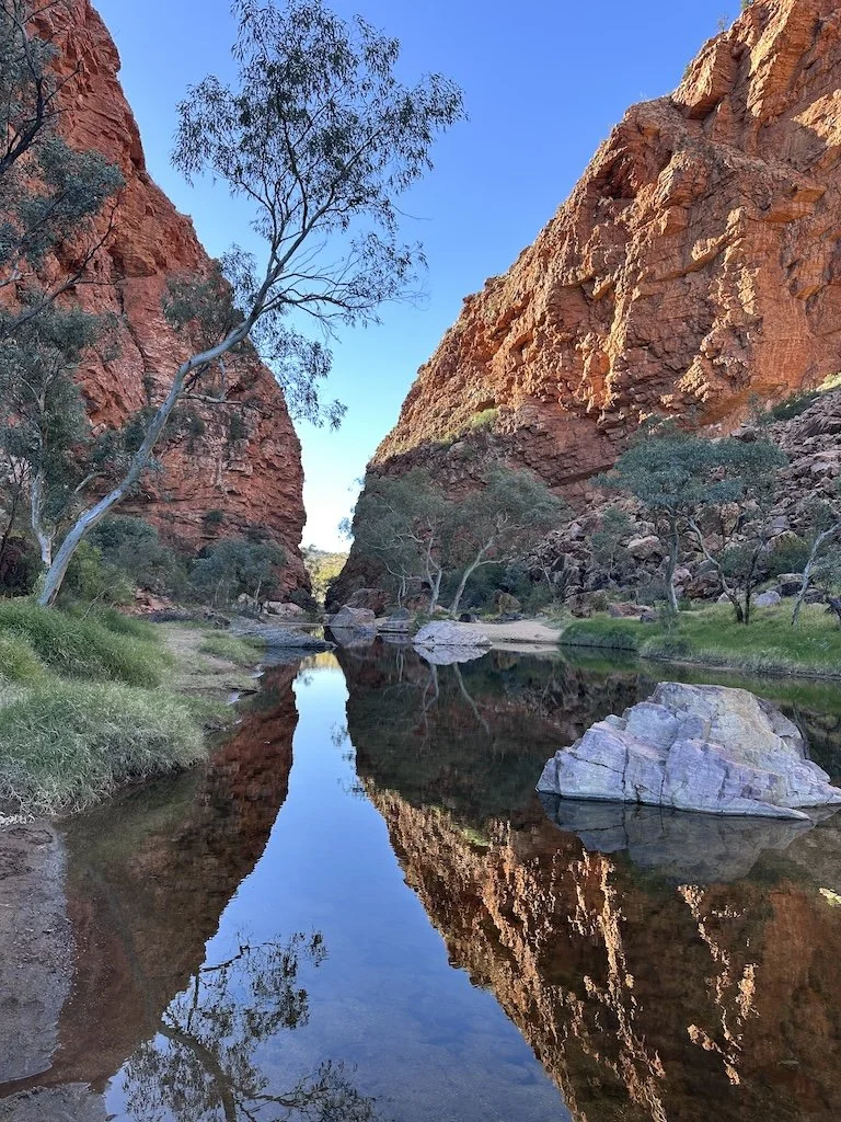
As the sun dipped in the sky, the last of the tour groups rumbled by in their enormous sightseeing buses, the smell of diesel lingering in the air. The desert earth breathed a sigh of relief and so did we as we made our way up the dry riverbed of the Roe Creek to Simpson’s Gap.
The last of the sun’s rays warmed the spectacular cliffs which soared dramatically above a permanent waterhole. Silence descended as we gazed from the vibrant red cliffs to the mesmerising pool below where ghost gums gracefully mirrored the world above.
We sat mesmerised as dusk descended, cloaked in a sense of peace and tranquility. Stars appeared and twinkled merrily back at us from the black pool, the depths of which was impossible to guess.
Day 3 Simpsons Gap to Jay Creek
We walk gingerly through the remnants of the burnt forest, amazed at the speed at which the new growth was somewhat miraculously starting the cycle all over again. The last major bush fires ravaged this area of the Tjoritja (West MacDonnell) National Park in 2023 at that time causing eight of the twelve Larapinta Trail sections to be closed. The preceding two years of high rainfall resulted in plentiful grass growth and it was the burning grass on neighbouring pastoral leases that then spread into the Park.
There are "light no fire" signs at every shelter and campsite, warning of the possible hazards and we’re extremely mindful of our camp stove, taking extra precautions to prevent a disaster. In this massively open landscape, it’s only too obvious how difficult it would be to try to contain fires. Ruminating on the speed at which fire travels isn’t helpful but perhaps explains the limited wildlife. So far, we’ve seen just one solitary grey kangaroo.
We’re starting to relax into the natural flow of the trail and are now setting our alarm for 5:30am so that we’re able to walk the bulk of the day’s kilometres before it becomes too hot. We’re heading west, away from Alice Springs and the relentless sun tracks our progress throughout the day.
Feeling the effects heat, we endured our lunch break in the unappealing, dry and dusty Mulga campsite though I can’t completely blame the location for the unappetising lunch.
In the morning I’d made an absolute rookie mistake by not drying our saucepan properly before adding in the stove, lighter and tea bags. My lunch break was spent laying out damp tea bags in the now useful sun and only time would dry the stove and lighter. In the meantime we cold soaked our lunch.

Bond Gap, Larapinta Trail, Australia
Though still scorching hot, we gave up early on our lunch break and were delighted when within twenty minutes walking we found ourselves alongside the cooling waters of Spring Gap. Backpacks were immediately ditched as we found a spot of shade to sit and relax in.
Dragonflies kept me entertained as I watched them fly forward, backward, up, down and even side to side. Whenever one stopped to hover in midair, I attempted to film it but alas, was never fast enough for those agile predators.
Tiring of their antics I focused more closely on the water which looked most inviting. Many of the waterholes on the Larapinta Trail are sacred and touching the water, let alone swimming in it is taboo.
In the midday sun, the still water was clear with barely a ripple to ruffle it’s glassy surface. To my fascination there were hundreds, possibly thousands of tadpoles swimming frenetically in the shallows.
Spencer’s Burrowing Frog has the ability to survive in this harsh desert environment by burrowing under the ground for months at a time waiting for conditions to come right before appearing once again. Once out, it’s all on as they’ve only a brief window of opportunity to find their mate and get on with the important business of being a frog before leaving their spawn in puddles.
It’s the tadpoles from that spawn which I was now watching with some fascination. The waterhole wasn’t huge and was likely to dry up altogether, time was of the essence as these amphibians take sixty days to develop into frogs.
Feeling more rested, I carefully scooped up a capful of water before placing my cap back on my head knowing that as we headed up the next hill, having a wet head would help to keep me cool.
Day 4 Jay Creek to Standley Chasm
Food is a hot topic amongst hikers everywhere as in how much, what is it and where and when do you get more. We’re constantly checking out what everyone else is eating and they are doing likewise.
With the Larapinta Express providing food drops along with trail transfers, we’d been quick to seize the opportunity.
We planned to be on the Larapinta Trail for a total of twelve days and had arranged for food drops at Standley Chasm and Serpentine Gorge. This meant we’d only need to carry four days of food at any one time.
This resupply timetable suited us well as it’s been a while since we’ve carried a full load and figured why make the trail any harder than it needs to be.
Radix Nutrition had generously provided all the food for our walk but that’s not going to stop the temptation of something fresh once we reach Standley Chasm tonight!

Get Your Trail Ready Meals Now
When heading out on trail I always make sure to take my favourite trail food - especially for those extra big days!
Meals can be ordered online and then sent on directly to your resupply point saving you time and money.
Radix Nutrition meals are designed to provide the nutrients you need to perform and thrive.
Learn more here and use my code FREEWHEELINGKIWI15 for 15% off!
From Jay Creek there’s a choice of two routes for our morning walk over to Miller’s Flat however Andrew’s been suffering from pain in his leg so we chose the relatively flatter section. Our friends Jake and Ellen chose the high route and later when they caught up with us, their description of scrambling down the mountain with very little trail to follow confirmed we’d made the right choice.
The Larapinta Trail is characterised by rugged, rocky and mountainous terrain with significant ascents and descents. With Andrew’s leg concerns, given the choice of swerving one of those early descents means we’ll have more strength to continue once we get to the bigger and unavoidable mountains such as the awe inspiring Brinkley Bluff and climatic Mount Sonder.
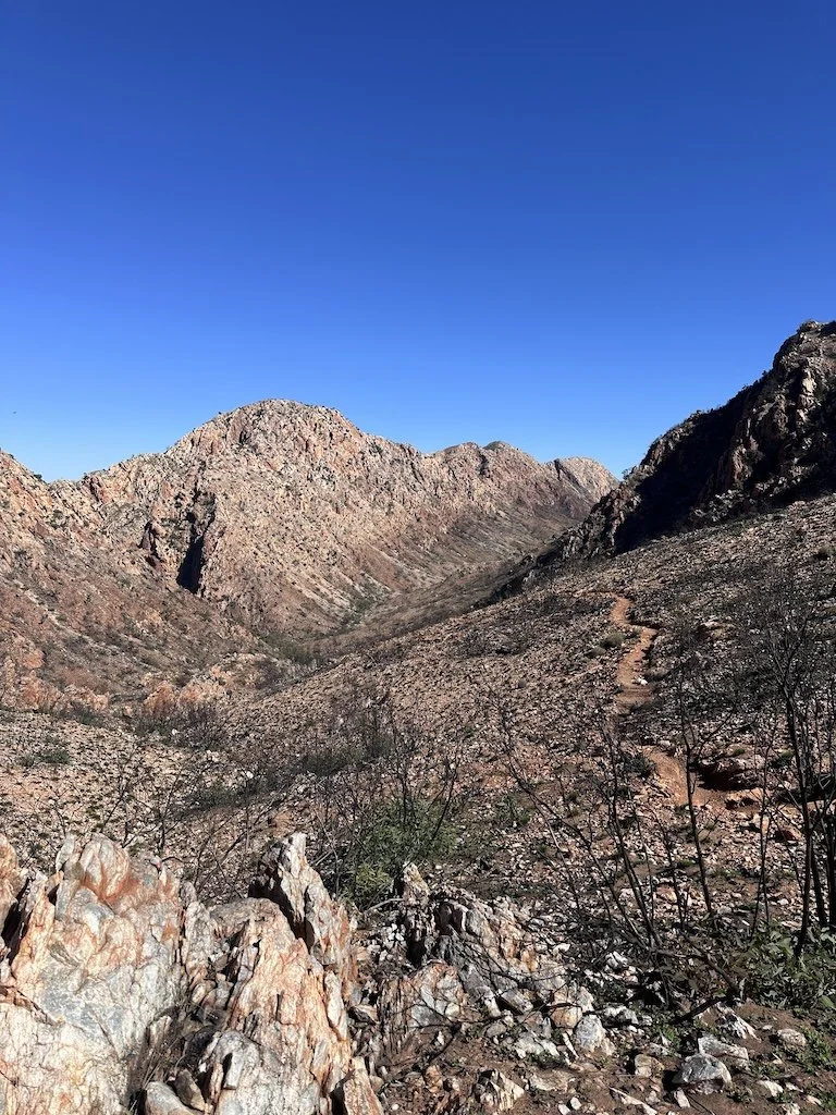
This didn’t mean there’d be no hills to climb. The Larapinta Trail follows the Tjoritja / West MacDonnell Ranges, criss crossing back and forth from the north to the south by going up sidlings and over saddles or by following narrow ridge lines.
For a change from climbing over the range, the trail passes through spectacular gorges such as Ormiston Gorge, Serpentine Gorge and Ellery Creek Big Hole.
With very little in the way of tree cover the spectacular outback scenery with it’s unique flora and fauna, spectacular mountain ranges and stunning waterholes are on constant display. The lack of shade also means we’re exposed to the sun from dawn until dusk and a wide brimmed hat plus sun screen are a must.
MacDonnell Ranges, Larapinta Trail, Australia
Ascending a wide open sidling I caught up with Andrew who’d earlier forged ahead as I struggled over large boulders. With his greater height, he takes fewer steps than I and it’s particularly noticeable when we are traversing any technical terrain such as today’s walk.
Andrew had stopped to chat with a couple of hikers travelling in the opposite direction, this pair hailed from Alaska and were members of a guided walking group. We’d previously run into the other parties of their group who were presently somewhere behind us.
I was suitably impressed to learn they were in their late 70’s and it made sense that they were only undertaking a portion of each day’s trail. They travelled ahead by 4WD vehicle and then walked in to meet their group. I loved that this flexibility was available to hikers, enabling more people to undertake portions of the Larapinta Trail as suited their ability.
Given the appearance of day hikers, we presumed we must be getting near to Standley Chasm which was confirmed sometime later as we entered the east end of the Chasm.
Standley Chasm is accessible by vehicle and understandably popular with tourists who can reach the Chasm within an easy fifteen minute walk. It’s also popular amongst the hikers given that there’s a cafe and gift shop plus the all important food drop collection point and overnight campsite with showers and a laundry!
But our day wasn’t over yet, rather than simply walking through the Chasm, the trail diverted for two more seemingly unnecessary steep pitches. With an increasingly painful leg, Andrew was clearly in some distress and didn’t take kindly to these last two pitches nor their haphazard trail.
After resting at the campsite, again, we waited for the bulk of the tourists to leave and the cool of the late afternoon before returning to view Standley Chasm from the west.
As we approached, lush cycad’s lined the pathway and entering the narrow gorge, the stunning eighty meter high walls soared impressively above us. The late afternoon sun warmed the red rock providing a striking contrast to the dark green of the cycad’s.
Day 5 Standley Chasm to Section 4/5 Junction via Brinkley Bluff
Despite having intermittent leg pain now compounded by nasty blisters, Andrew has gamely committed to continuing the Larapinta Trail.
Although the trail is located in the Red Centre of Australia which is in itself isolated, with twelve trail heads each accessible by vehicle we’re only ever a day’s walk from an exit point. Even from the Red Bank Gorge trail terminus, it’s an easy two hour’s drive back to Alice Springs.
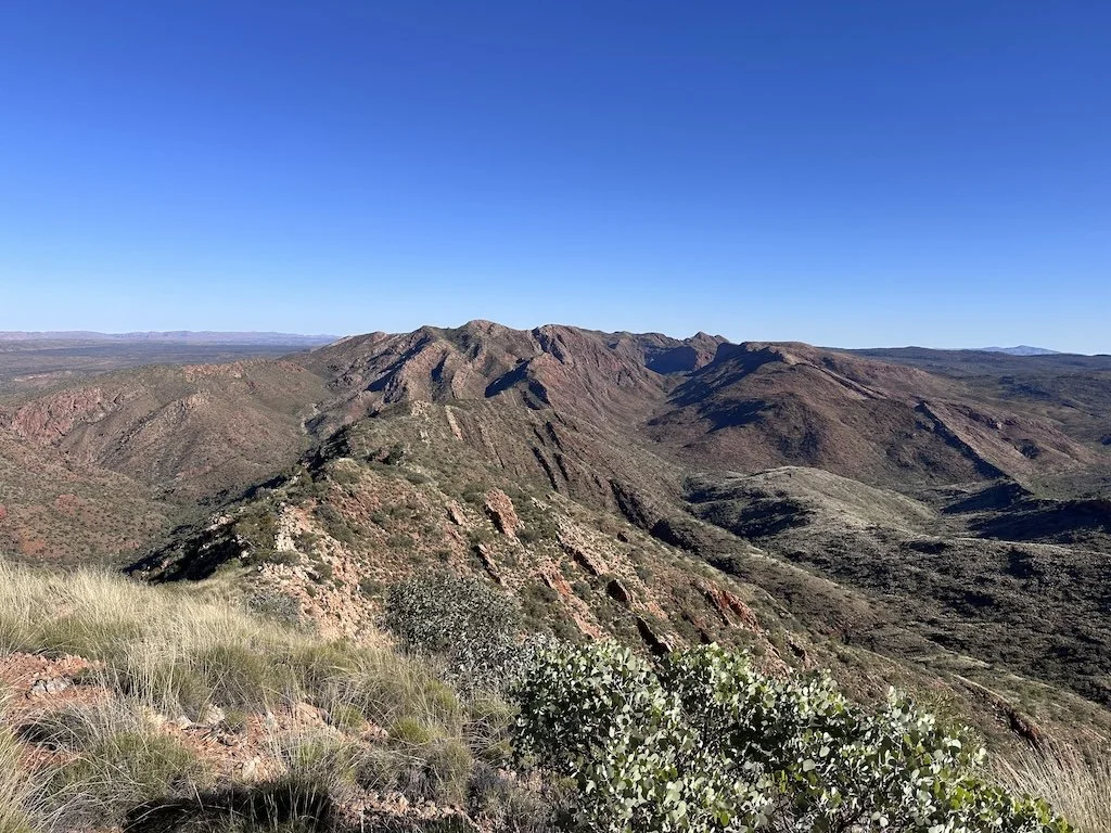
The air felt cooler as we rock hopped our way up the dry river bed though in the back of my mind, I’m conscious that it is this type of rocky terrain that is causing Andrew’s leg discomfort. We continue to climb and quickly reached Reveal Saddle, momentarily enjoying the views back down the way we’d climbed. Pushing on we continue ascending the Chewings Range, trying to complete the climb to the 1,209 metre Brinkley Bluff before it becomes too warm.
The higher we climb the more extraordinary the views and I pause often to look back over my shoulder. Rugged mountain ranges with sharp uneven peaks and ridges reveal themselves as we climb further.
We couldn’t be further from the sea, yet many millions of years ago, this was home to an ancient ocean. In a dramatic twist, a collision between tectonic plates pushed the land upwards, layering and folding it as it went. Since then natural forces such as wind and water have continued to weather and erode the softer top layers of the ranges, thought to have once reached potentially over 4,500 metres high.

Brinkley Bluff, Larapinta Trail, Australia
The erosion has exposed the harder, underlying rocks like red quartzite and created the many stunning gorges, gaps and valleys that characterise the Tjoritja / West MacDonnell Ranges today. I’m constantly tempted by beautiful rocks, picking the smaller ones up to observe them more closely.
Here, the trail is steep and challenging with jagged cliffs and sheer drop offs and I’m thankful it’s not a windy day. I’ve been caught out before in high winds and when combined with cliffs, it’s not fun.
Even at this elevation, the trees have been burnt to a cinder and Andrew and I contemplate what it would be like to watch an out of control bushfire approaching rapidly across the valley floor before sweeping up the mountain. Occasionally crows fly by hoarsely cawing to each other, it must be a incredibly tough environment to live in.
After being deceived by a couple of false summits, the stone cairn at Brinkley Bluff appears on the distance horizon and we gladly make our way there for an early lunch.
Brinkley Bluff is one of the twenty six designated Larapinta Trail campsites and certainly, one of the most spectacular. Low rock walls have been formed to provide a little shelter for tents and hikers from the prevailing wind though on our visit, there was thankfully barely a breeze.
Many of the designated campsites have serviced water tanks but not this one a top the mountain. Overnight hikers have to carry enough to see them through the night and on to to the next site. Brinkley Bluff campsite also has a toilet which has conceivably the best view from a public toilet in Australia.
As I soak my Smokey BBQ Radix Nutrition lunch my gaze takes in the awe inspiring 360° views till I’m brought back to the present by Andrew talking excitedly on his phone.

Brinkley Bluff Campsite, Larapinta Trail, Australia
Turning, I see him grinning from ear to ear, sore legs and blisters forgotten as he speaks to his daughter Erica back in New Zealand who’s sharing the wonderful news of her engagement to Bayley.
Day 6 Section 4/5 Junction to Hugh Gorge
Winter is the best time to walk the Larapinta Trail as in summer it’s simply too hot to be safe. We came prepared for the huge temperature variations that this arid region is known for and so far have experienced temperatures ranging from a toasty 26° celsius during the day to a chill 2° overnight.
Even though I’ve a sleeping bag with a comfort rating of -10° celsius and sleep in basically all my clothes I am still kept awake by the near freezing cold whereas Andrew casually wears a T-shirt and drops off the moment his head hits the mat.
There’s been record rainfall this season and I enjoy the many beautiful wild flowers alongside the trail. When choosing our June trail dates, we wanted to still benefit from the beauty created by the autumn rains while not being overly exposed to the winter cold.
A sign that we’re approaching another waterhole is an increase in the bird life and I’m rapt to see small flocks of noisy green budgies moving from tree to tree. Their constant chattering, chirps, whistles and trills becomes our new soundscape.
Some of the smaller waterholes are already drying up and smelling the decaying pond weed, I wonder how the tadpoles are getting on. There’s not been a single cloud in the clear blue sky since leaving Alice Springs six days ago and as someone who seems to attract the rain, I could get used to this.
As we enter the narrow and rocky Serpentine Gorge the trail disappears completely and we each figure out our own best approach up and over the large rocks. Where it’s sandy, we occasionally spot footprints which guide us forward, there’s no getting lost though it’s either go forwards or backwards as the vertical rock walls do not invite hikers to stray from the gorge.
We navigate around a permanent waterhole, river red gums and cycads which are thriving in the shade of the gorge.
There’s a strange clattering noise coming from up ahead, turns out to be an east bound hiker who’s throwing his hiking poles down each miniature bluff as he descends the gorge. He looks completely spent.
Although a challenging walk, I enjoy the narrow, snake like gap, so different to the previous gaps or gorges we’d walked through. Realising it’s not one to be easily visited by day trippers and mass tourism gives this gorge a peaceful and untouched vibe.
Razor Back Ridge, Larapinta Trail, Australia
We stop for a rest above Razorback Ridge, contemplating what will be our descent along it’s narrow, exposed spine. Sheer drops either side suggest that this is going to be a demanding walk requiring deliberate foot placement.
Previous hikers had taken a false trail, descending steeply into a deep gully only to have to climb all the way back out. As we begin to move downward I’m glad for my hiking poles which help with the rough, uneven ground which is peppered with loose rocks. Our efforts are rewarded with unparalleled panoramic views of the surrounding red rock landscapes and far below, the Fringe Lily Creek.
Though the challenging trail keeps me in the present, niggling in the back of my mind is Hugh Gorge or more specifically, the inescapable, deep waterhole in Hugh Gorge.
As it tracks through the Chewings Range, the Larapinta Trail follows many natural watercourses and at this time of year, I’ve read that there’ll be pools to negotiate in Hugh Gorge. In fact, there’s one waterhole that featured repeatedly as one that would need to be swum through.
As someone who likes to be (over) prepared, I’d watched videos on how best to manage the swim while not completely soaking your backpack and all its contents.
Since commencing the trail, I’ve also asked many of the hikers we’ve passed exactly how deep the water is at present and as expected have been given a variety of answers dependant on that person’s height! What might be mid thigh for them is going to be waist deep for me.
While I’m a competent swimmer, it’s not something I choose to do regularly as I loathe cold water and I’ve already experienced what feels to me like near freezing water in the preceding gorges.
As you can see, I’ve overthought this whole hole thing and while I’m anxiously ruminating on how cold it’s going to be the aforementioned waterhole appears abruptly before us.
Day 7 Hugh Gorge to Ellery Creek North
I think it was the sound of the zip that first woke me and opening my eyes, could see Andrew peering out into the moonlit night. In my sleepy state, I speculated why he didn’t just go out and zip the tent back up instead of letting in all the frosty air. Most nights one or the other of us ends up going to the lou and thank goodness we’ve a tent with a door either side!
Having lived in this very tent for many months while we walked New Zealand’s 3,000 kilometre Te Araroa, we are well versed in it’s features and also, how best to get by in such a small space with the least disturbance to each other. At this moment, Andrew was clearly not playing by the rules!
"There’s two dingoes" he whispered, immediately getting my attention and I quickly scrambled around in my sleeping bag, trying to get a look at Australia’s native dogs. Andrew crawled out of the tent to investigate but the shy dingoes were already retreating further into the darkness.
The Australian dingo is similar to a domestic dog but with distinct features such as a lean, athletic build, wedge shaped head and erect pointed ears. They’re typically reddish-yellow, perfect for blending into the desert though may also be black and tan or creamy white often with white paws, chest and tail tip.
Dingo’s are highly intelligent and adaptable carnivores that hunt in packs across a variety of Australian habitats however they’re not above a little scavenging on the side. Popping into the campsites along the Larapinta Trail to see if anything’s been left out potentially makes for a tasty snack.
We have a small dish cloth which we use for wiping our saucepan and it was this that had attracted the dingos to our campsite. The cloth had been hung high in a mulga bush beside our tent and the dingo had stretched up on it’s back legs and shredded it.
With nothing more to be seen, we settled back down though later when we were doing our final preparations in the pre-dawn light, those two cheeky dingos were once more skulking around within a couple of metres of Ellen as she refilled her water bottles.
Today is to be our longest day, crossing from the Chewings Range over to the Heavitree Range, a distance of around 30 kilometres. The vast Alice Valley is a wide open valley with continuous small rises and dips and I again enjoy the diverse vegetation with many wildflowers and small shrubs.
The track varies between rocky undulating rises and a smooth sandy path and as is our habit when walking on sand or fine dirt, we look at the shoe prints to gauge who else is about. Several hours into the walk, we noticed bare foot prints and I guessed they belonged to a female a little shorter than me. While there were patches of sandy trail, for the most part is was sharp rock and it was hard to imagine why anyone would choose to walk barefoot.
Reaching the Ghost Gum Flat campsite, we meet our bare foot hiker who is in the process of packing up her belongings. Stopping briefly to chat and check in that everything is alright, we both notice the still warm, open fire. Despite numerous written warnings, this hiker has chosen to ignore them, effectively placing us and the environment in danger. We make no comment but can’t help but privately make judgements.
Within minutes of leaving the Rocky Gully campsite where we’d refilled our water bottles, we once again come across the bare foot hiker who is now sitting stark naked filtering her water alongside a puddle. Again, we do not interfere with her lifestyle choices however her conduct raises many questions to which I’ve still no answers.

Ellery Creek North, Larapinta Trail, Australia
It was fascinating to observe the Chewings Range from which we’d departed as the sun rose to now look forward to the Heavitree Range basking in the late afternoon sun. The changing sunlight on the parallel mountain ranges was spectacular.
From one of the interminable knobs the trail insisted on taking us over (as opposed to walking around) we’d long since established where the Ellery Creek North campsite was. When the trail bisected a dusty 4WD track, I was more than tempted to follow it to the campsite to avoid more of the seemingly unnecessary ups and downs. I can also imagine that the trail maker has a sense of humour.
Day 8 Ellery Creek North to Serpentine Gorge
Returning from the lou in the pre dawn light, I knew before Andrew had even said a word that things weren’t good, specifically, the palm sized blisters that were now raging below his ankles. After battling for days with the excruciating pain, he needed relief.
When walking Te Araroa we’d both suffered enormously from persistent bisters and on that walk it was me that finally needed to detour off track to sort out the injuries. Andrew had been able to walk through his pain then and if he can’t do the same now, I knew the pain must be appalling.
Water availability on the Larapinta Trail is extremely limited and surface water depends on large rainfall events that in Central Australia are rare and unpredictable. There’s fifteen ranger monitored tanks spread across the trail at different campsites - those accessible by 4WD - which with forward planning, makes the walk manageable.
As all the water is brought in by 4WD and in small quantities, its strictly limited to drinking and cooking needs. There’s signs on all tanks to remind you not to waste it on washing either yourself or your clothes and equipment.
In this dry, dusty environment it’s near impossible to keep grime from accumulating in your shoes and this has become an issue for Andrew. Added to the grime is the heat as our first aid bandages and plasters will not stick to a clammy surface.
Tempted to stay another night at the beautiful Ellery Creek North campsite so that Andrew could rest up after looking at our options we decide to push forward to Serpentine Gorge which was only around twelve kilometres away.
We knew from our planning that the team at Larapinta Express came regularly to the trailhead at Serpentine Gorge as this was to be our next food drop.
As always, we hike with a Garmin InReach which allows for two way communication and I quickly sent out a message to Alex and Anna at Larapinta Express to co-ordinate a transfer.
Although not sure what day of the week they’d be calling into the Serpentine trailhead, we figured if we were there, we could simply wait it out. After all, we’d also have our next four days of food!
The campsite at Serpentine Gorge features one of the impressive Larapinta Trail shelters which offer a roof, back and part side walls and raised platform for sleeping on. The shelters also have solar powered charging stations though we never managed to achieve any charge from them, having instead to rely on our own power banks.
Earlier in our walk we had slept on our mats, on the metal platforms, however after a couple of freezing nights, had come to the conclusion that no matter how sheer, the tent offered more protection from the cold. The advantage of using the platform was not having to set up a tent and should it ever rain, this would be very useful.
Dotted around the shelters were half a dozen small campsites suitable for a double sized hiker tent. The shelter became the centre of activities in the evening as hikers came together for their meals, to chat and share trail stories. There are also excellent interpretation and information signs at the shelters and in addition, each shelter has tank water and a vault or long drop style toilet.

Near West Junction, Larapinta Trail, Australia
While on trail it’s the people you meet that gives the adventure considerably more depth and while waiting for our transfer at Serpentine Gorge, we were sad to say goodbye to Lauren and Jonathon who we’d been walking with since Standley Chasm.
Jake and Ellen were also planning to go to Ulara and Uluru after the Larapinta Trail and we made tentative plans to meet up again. With the turn of events brought about by Andrew’s injuries, both these couples had immediately offered support which is so very special and humbling.
Due to the shared experiences while on trail, we tend to forge deeper and faster friendships. Whether we’re enjoying a sunset in the middle of nowhere or facing adversity together there’s opportunities for genuine connection, mutual support and vulnerability which creates a strong bond.
We watched as Alex from Larapinta Express drove into the carpark with mixed emotions. Relief for Andrew as he’d soon have support for his injuries, sadness yet pragmatism at prematurely leaving the trail, gratitude for the experience so far and appreciation for the support offered by Alex and Anna. We’d first met Alex when he dropped off our resupply box back in Alice Springs and the assistance provided by he and his wife, Anna was proving to be invaluable.
Day 9 Red Bank Gorge to Mount Sonder
After a couple of days rest and recuperation at the YHA in Alice Springs, Andrew was ready to (cautiously) tackle the trail once more. Due to time constraints however it was no longer practical for us to pick up where we’d left off. Alex once more rose to the occasion and transferred us to the Red Bank Gorge trailhead which is the western terminus of the 230 kilometre Larapinta Trail.
The road from Alice Springs out to Red Bank Gorge loosely parallels the Larapinta Trail and before long, the distinctive twin-peaked profile of Mount Sonder came into view. These were the landscapes beloved by world renowned artist, Albert Namatjira and thanks to my Australian mum, I’d grown up with one of his characteristic prints on our wall at home.
Mount Sonder (Rutjupma) is the fourth-highest peak in the Northern Territory at 1,380 metres and is a popular destination for sunrise or sunset hikes. The mountain offers breathtaking yet desolate views of the ancient Tjoritja / West MacDonnell Ranges and in all ways, is a highlight of the Larapinta Trail.
Under the circumstances, we had decided not to attempt either a sunrise or sunset climb as either way, half the trip is done in the dark. Sunrise in particular is very cold, often times with ice near the summit and we didn’t want to take any risks with Andrew still dealing with injuries.
Each trail campsite that coincides with an easily accessible trail head has been positioned at some distance from the public area and car parks. Most we found to be tucked away privately from where the day trippers went which gave a greater sense of security.
Stashing our packs inside our tent, we headed towards the mountain, excited to be taking part in this final section of the Larapinta Trail. Being the middle of the day, there were very few people on the trail and we gradually made our way up the hill.
Carrying only a day bag with the bare minimum of emergency gear is certainly easier that hiking with fifteen or more kilos on your back and having had two days rest in town, I was feeling strong.

Mount Sonder, Larapinta Trail, Australia
Unhappily, Andrew’s blisters were still giving him grief and we stopped at just under 1,000 metres for him to have a break. Dropping down out of the cold wind, we sat in the sun admiring the views towards the inspiring Chewing Mountain Range with Mount Giles (at 1,389 metres it’s the third highest) standing tall above them all. Looking skyward, wedge-tailed eagles soared the thermals, effortlessly circling higher and higher. As the sun warmed us I was pleased to see Andrew relaxing back on the rocks.
Life Lessons
We sat quietly and I thought once more that it’s the whole adventure that offers value, not just an arbitrary summit or trail terminus.
On every adventure as in life, Andrew and I know to listen to our bodies and evaluate our limits so as to avoid further injury or exhaustion. Although we felt we were prepared for the Larapinta sometimes stuff just happens that is beyond our control and when that’s the case, we’re more than adaptable.
Sitting high on that mountain and surrounded by the enormous vastness that is Central Australia I thought of all those people who were unable to do what I do and as always, that perspective brings with it humility.
For now, there’s always tomorrow.
Day 10 Red Bank Gorge to Alice Springs
The Larapinta Trail can be walked in either direction though the official Larapinta Guide has you going in the direction we did which was from Alice Springs to Mount Sonder. That is, from the east to the west.
In that direction, it would seem the further we walked, the more extraordinary the views became before culminating at the spectacular Mount Sonder and nearby Red Bank Gorge.
There’s been many major highlights on our walk including Simpsons Gap, Ellery Creek Big Hole, Standley Chasm, Brinkley Bluff and yes, Hugh Gorge with it’s deep waterhole.
Each day we’ve been delighted by the fauna be that the cheeky budgies, soaring eagles or capricious dingos. We’re gratified to see after the shocking bush fires the reemergence of the flora, the wild flowers, the ghost gums and cycads amongst others.
As the trail quickly became our home, we have been charmed by the people we met - other hikers and the businesses supporting the trail hikers - each person adding to our Larapinta Trail tapestry as we did to theirs.
Now we’re at the end of the trail we don't have much time before the Larapinta Express is due to collect another load of trail weary yet happy hikers back to town.

Red Bank Gorge, Larapinta Trail, Australia
But first, there was one final thing to do, one final walk, one final goodbye.
At this early hour, the sun had not yet penetrated the deep gorge at the base of Mount Sonder and the temperature remains fresh. Towering red rock walls soared high above me as I turned and looked deep into the seemingly bottomless waterhole. Ghost gums clung precariously to the lower walls and somewhere far above, a wallaby scrambled sure-footedly from rock to rock.
As with so many of the sacred gorges that we’ve had the privilege to visit in the Tjoritja / West MacDonnell Ranges, a sense of peace pervades the atmosphere. It’s impossible not to feel the deeply spiritual and cultural significance that these ancestral lands represent to the Arrernte Aboriginal who have lived here for around 40,000 years.
That alone is an extraordinary concept and it’s comforting to know that the traditions and connections to the Dreamtime at Red Bank Gorge are recognised and protected.
As with every adventure, the Larapinta Trail forced us to confront the limits of our control and in doing so taught us greater patience, resilience and the difficult art of letting go. We were challenged to create our own closure and to find resolution not in the answers we sought but in the strength we discovered within.
I anchored myself in the present and sat for awhile breathing in the silence, the spirituality and the extraordinary beauty, then as I readied myself to leave, I made a promise to one day return.

West MacDonnell Ranges, Larapinta Trail, Australia
Ready for more? Watch the daily vlogs below
“Now more than ever do I realize that I will never be content with a sedentary life, that I will always be haunted by thoughts of a sun-drenched elsewhere.”
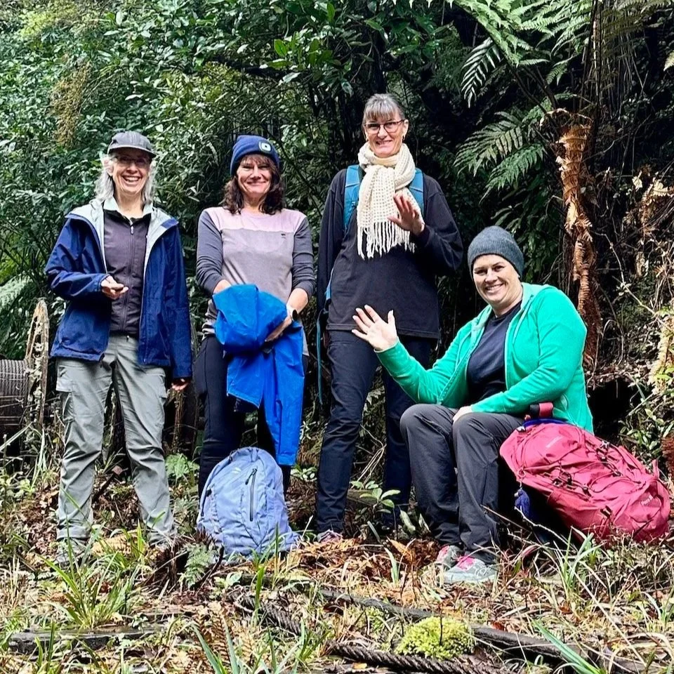
There's a particular kind of quiet that settles over a group standing above a lake nobody's spoken about yet. That was Rotongata, sun on the water, no one in any hurry to say something.
The July Reset and Recharge Walk took us into the Ōkataina Trails near Rotorua, through towering kahikatea, twin crater lakes, and a 10 metre waterfall called Te Auheke — tumbling water.
This is the story of that day.