Larapinta Trail Outdoor Survival and Fire Safety Guide

Larapinta Trail Outdoor Survival and Fire Safety Guide
The Larapinta Trail is an incredible adventure and one that I thoroughly enjoy and recommend! But it’s also rugged, remote and fire-prone, especially in the hotter months from October through to March.
So as to take advantage of the cooler day time temperatures, we hiked the Larapinta Trail in June which is during the Australian winter. Fortunately we had no exposure to active bushfires though the threat of them in this area is not to be underestimated. There were many days on trail when we navigated through areas that had previously been burnt out and the threat of a fast approaching, out of control bushfire does not bear thinking about.
Since you’ll be heading into Australia’s Red Centre where temperatures soar and bushfires are a real threat, your planning needs to be airtight.
How to get the most out of the Larapinta Trail Outdoor Survival and Fire Safety Guide
If you’re a beginner hiker who is planning to travel to the Australian Outback or more specifically, to hike the Larapinta Trail use the Contents List above to quickly navigate your way between sections. Once you’ve opened the Contents List, click any of the bullet points to jump straight to that topic.
Throughout the article, I’ve linked to further reading, products and services. To add further context, click on the images as they will take you directly to the relevant daily vlog.
Preparing to Hike the Larapinta Trail
Preparing for any outdoor adventure needs careful planning and particularly, if you’re a beginner hiker who is venturing into an isolated, fire prone desert such as in the Australian Outback. You’re dealing with the potential for extreme heat, dehydration risks, fire hazards and remoteness, all of which can be life threatening without proper preparation.
In this article I share with you my essential Larapinta Trail Outdoor Survival and Fire Safety tips

Andrew and Sharon, Brinkley Bluff, Larapinta Trail, Alice Springs, Australia
Larapinta Trail Overview
Length
The Larapinta Trail is a 230 kilometre hike from Alice Springs to Mount Sonder in the Tjorita / West MacDonnell National Park. It's pretty much smack bang in the centre of Australia and a heck of a long way from anywhere.
Sections
There’s twelve individual sections which can be done in parts or all at once, as a thru hike which is what we did.
Terrain
The terrain on the Larapinta Trail encompasses arid desert, rocky ridges and exposed plains. Throughout the hike, there’s limited shade.
Best Time to Go
The best time to walk the Larapinta is from May to August (during the Australian winter) as the temperatures are cooler and the fire risk is lower
To find out about current weather conditions for the area, go to the Bureau of Meteorology.
Fire Season
Fire season in Central Australia is typically from around October to March (from late spring through to autumn). If possible, avoid walking during the fire season or at least, do so fully informed as to the potential risks.
Gazing down the Razor Back Ridge, Larapinta Trail, Tjoritja (West MacDonnell) National Park
Essential Planning for the Larapinta Trail
Here’s a comprehensive checklist to help guide your planning:
Bushfire Awareness - Know the Fire Risks
Fire ban periods are common in the Australian Outback. Before heading out on any trails check with Northern Territory Fire and Rescue and the Northern Territory National Parks websites for updates on:
Current fire bans
Controlled burns
Bushfire alerts
Further;
Check the fire danger ratings (from local authorities or national parks services) before you go
Avoid peak fire season if possible - usually summer and early autumn (November - March)
Avoid walking in high fire danger days - watch for smoke, sudden wind changes or park alerts
If you see fire - retreat towards rocky ground or already-burnt areas and alert authorities via a Personal Locator Beacon (PLB) or a satellite device
Campfire restrictions - assume no open flames allowed and only use a camp stove if permitted

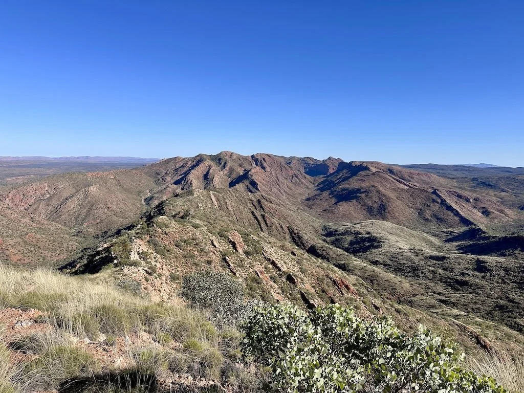
Brinkley Bluff, Larapinta Trail, Tjoritja (West MacDonnell) National Park
Water Planning and Strategy
Water is the #1 survival priority on the Larapinta Trail.
Carry more than enough water - in extreme heat, you may need two or three times what you’d typically drink.
Map out known water sources such as springs, tanks and water drops
Some tanks run dry - confirm with the Northern Territory Parks Water Update before departure
Treat all water - use a filter or tablets
Have backup water storage capacity - consider taking a water bladder or collapsible containers
Print a trail map with known tank locations

Waterhole, Serpentine Gorge, Larapinta Trail, Tjoritja (West MacDonnell) National Park
Navigation and Communication
Use paper maps and a compass - don’t rely solely on GPS as it can fail
Use a GPX file (on an offline GPS app like Gaia, AllTrails or Avenza)
Download offline trail notes and elevation profiles
Bring a satellite phone or Personal Locator Beacon (PLB)
There’s no phone coverage on most of the trail
Mark evacuation routes and fire escape options - like ridge lines or firebreaks
Some sections are very isolated - don’t over estimate your daily distance in high heat

Standley Chasm, Larapinta Trail, Tjoritja (West MacDonnell) National Park
Fire Safety Essentials
Wear fire-resistant clothing - merino wool or treated fabrics over synthetics
Wear sun-protective clothing - a wide-brim hat, long sleeves and gaiters
Know how to recognise signs of a wildfire - smoke columns, ember showers, changes in the wind, the smell of smoke
If caught in a fire zone:
Move perpendicular to the wind direction
Seek cleared or rocky ground, low vegetation areas or natural firebreaks

Junction 4/5, Larapinta Trail, Tjoritja (West MacDonnell) National Park
Heat Survival Tips
Avoid walking during the midday heat or on high wind days - both increase fire risk and dehydration
Aim to hike from sunrise to around 11am, then rest in the shade before starting again as the afternoon temperatures cool
Know the signs of:
Heat exhaustion - dizziness, cramps, nausea
Heat stroke - confusion, collapse

Ellery Creek North, Larapinta Trail, Tjoritja (West MacDonnell) National Park
Trail Logistics
Section Resupply Points:
Standley Chasm and Ormiston Gorge may have food drops or kiosks
Food Drops - Use Larapinta Express or other Alice Springs based services or self arrange drop offs at:
Standley Chasm
Ellery Creek
Serpentine Gorge
Ormiston Gorge
Camping: Designated campsites - some with a shelter, water tanks and long drop toilets.

Junction 4/5, Larapinta Trail, Tjoritja (West MacDonnell) National Park
Gear Must-Haves for Fire Prone Desert Hiking
Sun protection - hat, SPF 50+ sunscreen, sunglasses, long sleeves, UPF clothes
Four plus litre water capacity
Satellite communication devices - ZOLEO, Garmin inReach, PLB
Emergency bivvy or space blanket - desert nights can be cold
First aid kit - include burn treatments and electrolyte packs
Food - calorie dense, non perishable items
Navigation tools - paper and digital

Hugh Gorge, Larapinta Trail, Tjoritja (West MacDonnell) National Park
Desert Survival Skills
Know how to:
Signal for help - use a mirror, whistle, smoke
Dig shade shelters or find natural cover
Recognise heatstroke, dehydration and hypothermia symptoms

Near Standley Chasm, Larapinta Trail, Tjoritja (West MacDonnell) National Park
Before You Go - Final Checklist
Register your hike with Northern Territory Parks
Leave a trip itinerary with someone reliable and include
Where you’re going
Your route and stops
Expected return date and time
Emergency contacts

Brinkley Bluff, Larapinta Trail, Tjoritja (West MacDonnell) National Park
In Summary
Tackling the Larapinta Trail is an unforgettable adventure, but it’s one that demands serious preparation especially as it’s a remote, fire-prone desert. Prioritise water planning, fire safety, navigation and emergency communication. Avoid peak fire season, stay informed and respect the harsh but beautiful environment.
With the right mindset and gear, you’ll be ready to take on the Larapinta Trail, safely and confidently.
Share your tips for hiking in the Australian Outback in the comments box below so that we may all learn and benefit from each others experiences.
Stay safe, walk smart and enjoy the journey through Australia’s ancient heart.
Ready for More?
Watch the Larapinta Trail Daily Vlogs HERE


The Larapinta Trail is an incredible adventure and one that I thoroughly enjoyed and recommend!
But it’s also rugged, remote and fire prone, especially in the hotter months from October through to March.
So as to take advantage of the cooler day time temperatures, we hiked the Larapinta Trail during June which is wintertime in Australia.
Fortunately we had no exposure to active bushfires though the threat of them in this area is not to be underestimated.
There were many days on trail when we navigated through areas that had previously been burnt out and the thought of watching a fast approaching, out of control bushfire does not bear thinking about.